|
 Other maps
 |
Download |
|
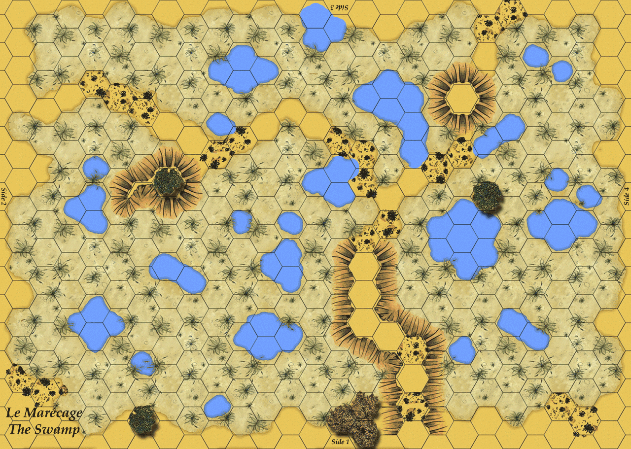
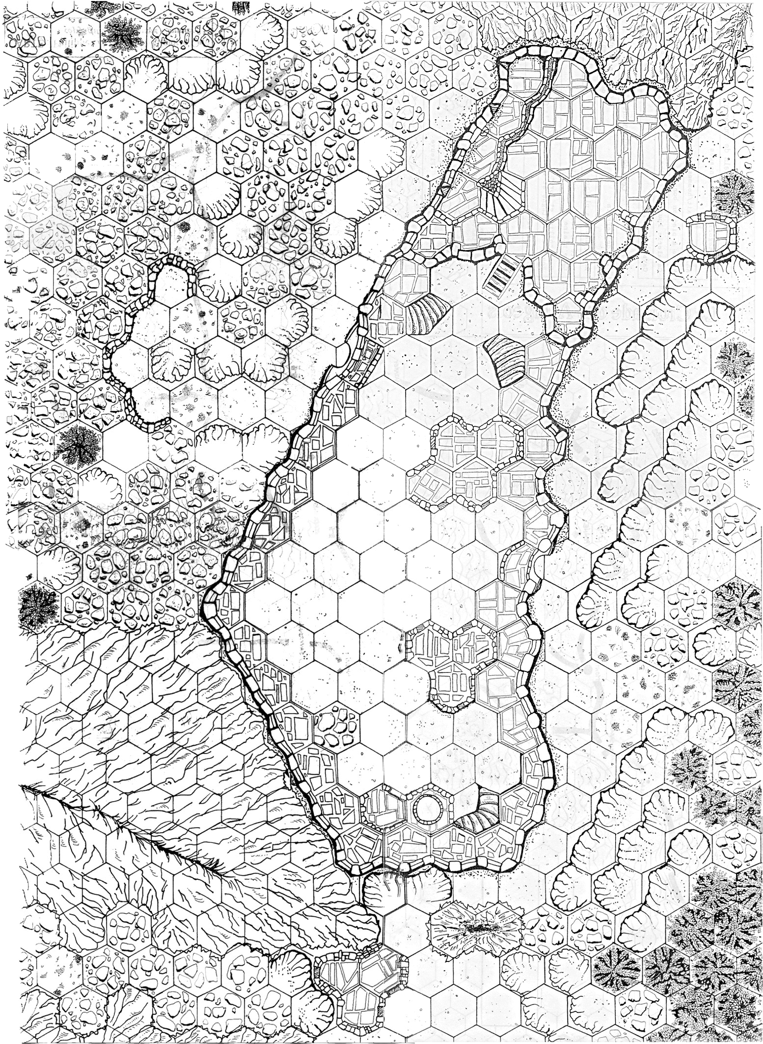
 The Swamp
 |
Map created by Eric Bertrand. |
Low Resolution (Color) - GIF 72 DPI
>
Swamp v
1.0
(A2 -1.4 Mo)
Dec 22, 2005 |
|
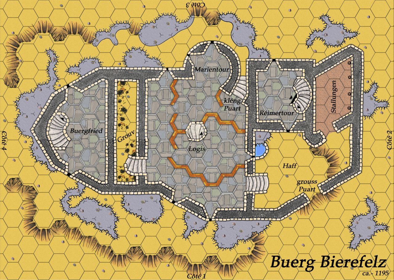
 Buerg Bierefelz - Level 1
 |
3-layer map created by Caranorn Aglaredhel and colorized by
Eric Bertrand. Scenarios are being written for this map. |
Low Resolution (Color) - JPG 72 DPI
>
Buerg
Bierefelz Level 1 v
1.0
(A2 -3.2Mb)
Oct 09, 2005 |
|
 Buerg Bierefelz - Level 2
 |
|
Low Resolution (Color) - JPG 72 DPI
>
Buerg
Bierefelz Level 2 v
1.0
(A2 -1.4Mb)
Oct 09, 2005 |
|
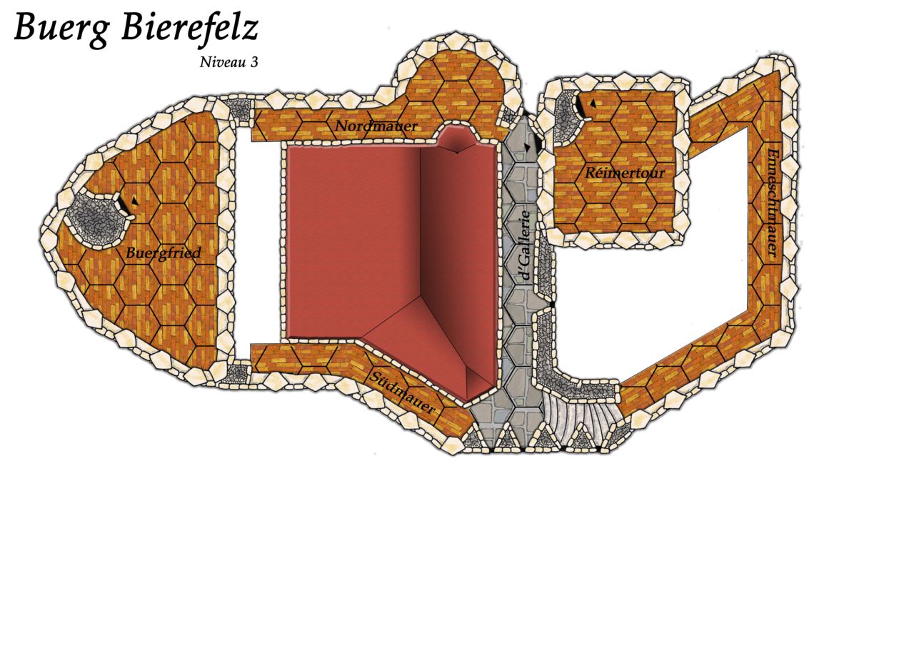
 Buerg Bierefelz - Level 3
 |
|
Low Resolution (Color) - JPG 72 DPI
>
Buerg
Bierefelz Level 3 v
1.0
(A2 -1.3Mb)
Oct 09, 2005 |
|
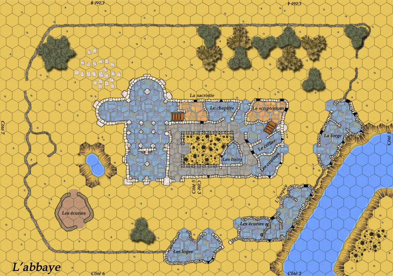
 The Abbey
 |
Map created in 1995 by Jief. Colored by Eric Bertrand.
Scenarios are on their way.
JPG 300 DPI (color) - Modified!
>
Abbey
v1.1
(2 ea. A2 -5.5 Mb) -
Aug 31, 2005
|
|
 The Fortified Bridge
 |
Map created in 1995 by Jief.
Colored by Eric Bertrand.
Scenarios are on their way. |
JPG 300 DPI (color) -
Modified!
>
Fortified Bridge v1.1
(A2 -2.8 Mb) - Aug 31, 2005 |
|
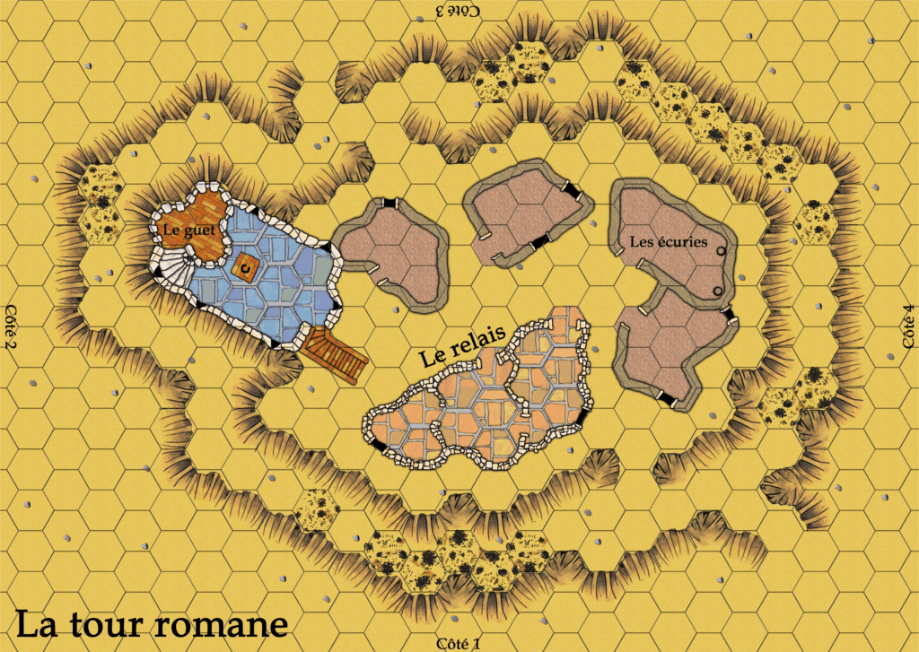
 The Roman Tower
 |
Map created in 1995 by Jief. Colored by Eric Bertrand.
Scenarios are on their way. |
JPG 300 DPI (color) -
Modified!
>
Roman
Tower v1.1
(A2 -2.8 Mb) - Aug 31, 2005 |
|
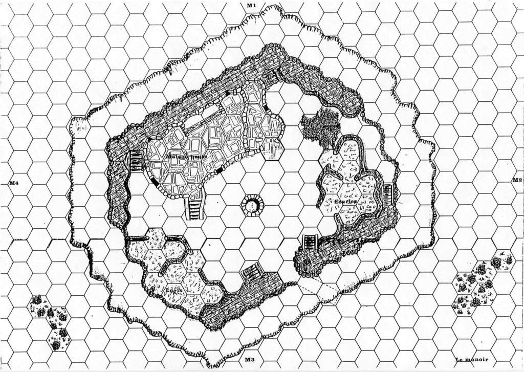
 The Manor
 |
Map created in 1995 by Jief. Scenarios
are on their way, as well as colorization. |
|
|
 The Outpost
 |
Published in "Le Journal du Stratège" Nr 41/42 in 1988 and
created by Pierre Berclaz. No scenario was associated with
it. Colorization and redesign by Eric Bertrand. |
Medium Res. - JPG 300 DPI
>
Outpost (Color)
- A2 -2.5 Mb
- Aug 31, 2005-
Modified!
Rules - RTF file - Same file for the mills, the outpost and
the tower tops.
>
Rules (91Kb) |
|
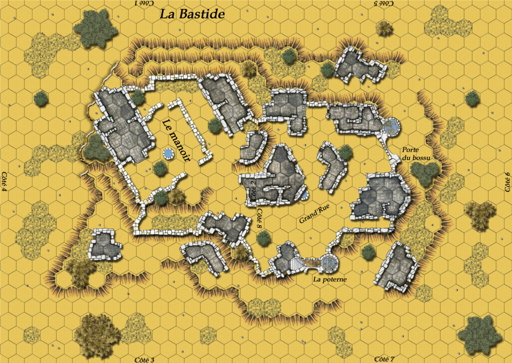
 The "Bastide"
 |
 |
This double board has been designed by Eric Bertrand for the
strategic game "The Albigensian Crusade", and as an addition
to the "Montsegur Castle"
board.
JPG 150 DPI (Color)
>
Bastide (2
ea. A2
-2.6Mb) -
Jan 26, 2005 |
|
 Strategic Map
"Albigensian Crusade" |
This map was originally designed in B&W by Philippe Gaillard
for his strategic campaign. Eric Bertrand redrew and
colorized it completely for use with his own flavor of the
campaign.
Note: An English translation of the map will come soon. |
JPG 150 DPI (color)
>
Albigensian Crusade
(A2 -3.1 Mb) - Jan 26, 2005 |
|
 El Khaf
 |
This board is a modification
proposed by Duccio Vitale pfor his scenario published into Casus
Belli Nr 51. Jo@rloc
designed it with a few edits. Many thanks to him! |
High resolution (Color)
- JPG 300 DPI
>
El Khaf (2xA2 -8.2 Mb)
- Jan 26, 2005 |
|
 The Village Wall
 |
This board (not to be confused with the upcoming Fortified
Village board, entirely new and still being designed) is a
simple assembly of the
Village board and
the various elements of walls proposed with the
Welsh Castle
(and for sale in the Shoppe).
One or several scenarios to use it are under construction,
as well as a Vassal version. |
Low Resolution (color) - GIF
>
The
Village Wall (A2 -
1.7 Mb)
- Jan 26, 2005 |
|

The Marsh |
Published in Claymore Nr 6 and part of a scenario about the
battle of Bannockburn. This board was created by Philippe Gaillard.
It is still in its original black and white rendering.
Colorization is under evaluation. |
Low Resolution (B&W) - GIF
>
Marsh (A2 -3.8 Mb) |
|

Castle of Montségur |
Published in Claymore Nr 4 and part of the
Albigensian
Crusade campaign. This map was created by Philippe Gaillard.
Colorization is in process by Beorthulf. |
Low resolution (B&W) - GIF
>
Montsegur (A3 -
1.7 Mb) |
|
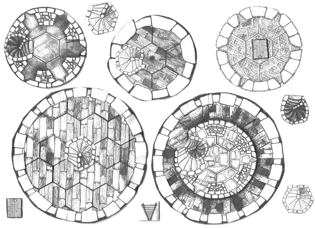
 Tower Tops
 |
These off-map cut-outs have been designed by Bob Gingell.
They are intended to provide multilayer game play when using
castle maps. |
Low Resolution - JPG 150 DPI
>
Tower Tops
(3 sets - 2.64 Mb)
Rules - RTF file - Same file for the mills, the outpost and
the tower tops.
>
Rules (91Kb) |
|
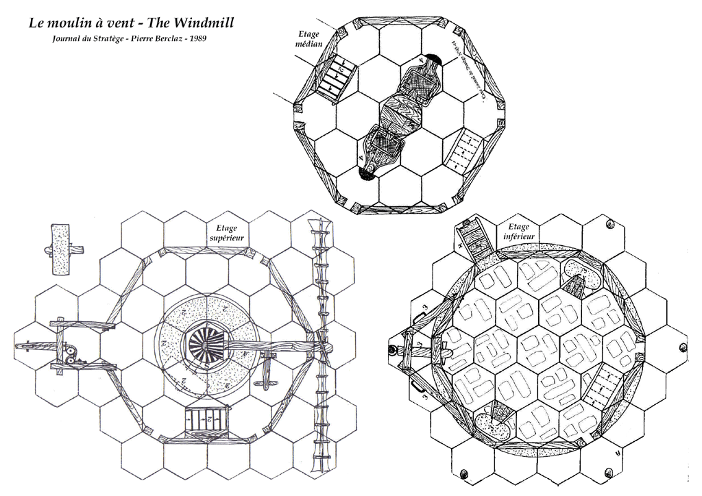
 The Windmill
 |
Published in "Le Journal du Stratège" Nr 43/44 in 1989 and
created by Pierre Berclaz. No scenario was associated with
it. |
Low Resolution - JPG 150 DPI
>
Windmill (A3 -665 Kb)
Rules - RTF file - Same file for the mills, the outpost and
the tower tops.
>
Rules (91Kb) |
|
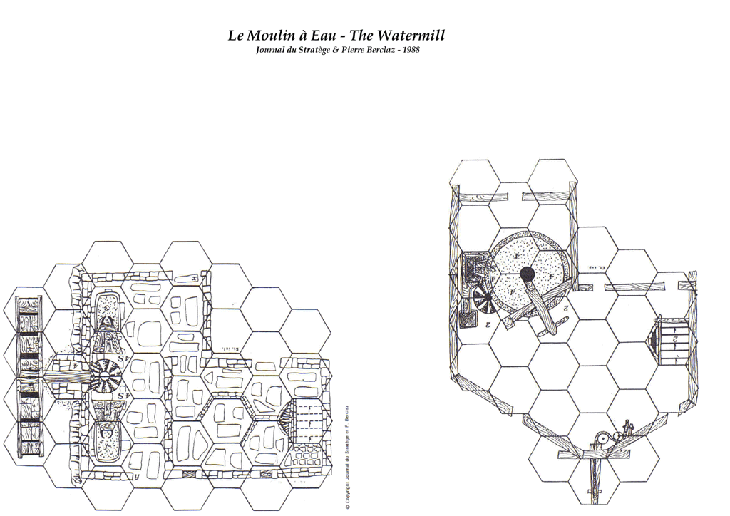
 The Watermill
 |
Published in "Le Journal du Stratège" Nr 41/42 in 1988 and
created by Pierre Berclaz. No scenario was associated with
it. |
Low Resolution - JPG 150 DPI
>
Watermill (A3 -576 Kb)
Rules - RTF file - Same file for the mills, the outpost and
the tower tops.
>
Rules (91Kb) |
|
Map created by Bertrand Merlier who cut and pasted several
elements from original maps. |
|

The "Tonlieu" |
High Resolution - JPG
(A4 - 1.1 Mb each)
>
ZIP file |


